Sanborn map
From LdsigWiki
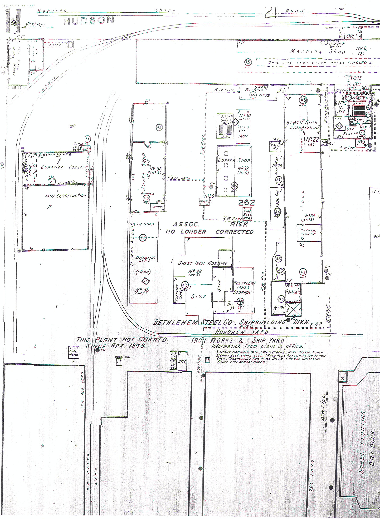
Sanborn Insurance Maps were made of 12,000 cities and towns across the United States by the Sanborn Map Company beginning in the 1867 for the purpose of assessing fire risk and setting insurance rates, and they were the primary American publisher of fire insurance maps for nearly 100 years. They include not only moderately detailed information about the location of structures, railroad tracks and streets drawn at a scale of 1"=50'-0", but they also include the height and material of the structures, location of doors and windows, cranes and other equipment, storage tanks, use of the building, etc. An invaluable tool when researching for a model railroad, they, along with photographs, track charts and ICC Valuation maps, can give a very accurate rendering of what was happening in most any urban area of the country begining around 1900. These maps can generally be ordered via Interlibrary Loan from your local public, school or university library if you have a library card. Some libraries will have the maps for the local area or state on hand in hardcopy format, and maps that are borrowed from other libraries will generally be on microfische or microfilm. Copies can be made for personal use.
The map below shows a part of the Bethlehem Steel Shipbuilding Yard along the Hudson River in Hoboken, NJ. The railroad tracks shown belonged to the Hoboken Shore Railroad, and run out on a 600' long pier. All the different phases of shipbuilding work can be identified in the map from rigging to copper smithing to painting.